Design store powered by Zazzle - custom gifts, personalized products, quality printing
Price: $49.50
Style: [24.0000,36.0000] (Choose more styles...)
Zazzle print created by VintageSketch (January 31, 2023, 7:54 pm)
Product ID: 256157671426011107
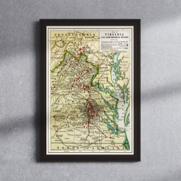
Published in 1912, this map shows the locations of Union vs. Confederate battles in Virginia and surrounding states during the Civil War period of 1861-1865. It also includes the major battles and campaigns, key roads, railroads, rivers, towns, and cities of the time period. It gives a vivid picture of the war and its effects on the Virginia landscape. The map provides an invaluable resource for historians, students, and Civil War enthusiasts alike. Edited by VintageSketch to repair age-related damage and to enhance for print.
Title: Map of Virginia and neighboring states showing the location of battles in the Civil War 1861-1865.
Published: Buffalo, N.Y., The Matthews-Northrup Works
Also shows: Maryland, West Virginia, Pennsylvania, North Carolina


